
Soil Survey Maps
What are soil survey maps?
Soil survey maps overlay the boundaries of soil types onto aerial photos; in order to identify the locations of different types of soil.
For online soils maps, see the USDA Natural Resources Conservation Service (NRCS) online Web Soil Survey at http://websoilsurvey.nrcs.usda.gov/app/
Soil maps for properties within the Riverside-Corona Resource Conservation District are published in the Soil Survey, Western Riverside, California.
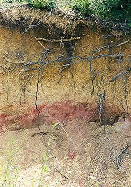
Soil maps can be used for site analysis, water management evaluation, erosion control planning, and Environmental Impact Reports. Soil surveys provide information about a soil's suitability for crops, building sites, roads, septic systems, and land use.
Soil surveys include information about a soil type’s infiltration rate, depth to bedrock or parent material, slope, load bearing capacity, shrink-swell capacity, and more. Included in the survey are the Unified and AASHO engineering classifications for each type of soil that is mapped.
If you would like more information about local soils, please contact NRCS District Conservationist Keir Thomas, with your property location (township, range, section, etc.) at (951) 594-0766, or Keir.Thomas@ca.usda.gov
To obtain aerial photos, contact the Riverside County Flood Control office or a private company, such as Rupp Aerial Photography in Corona. Find photos by visiting an online source, such as mapquest.com or google maps.
For maps, imagery, and data resources information search the USDA Natural Resources Conservation Service website at http://www.nrcs.usda.gov/wps/portal/nrcs/main/national/technical/nra/dma/